FlightZone Aerial Imaging LLC
  • Gallery
  • Real Estate Images
  • Community Images
  • Commercial Images
  • Inspection Images
  • Landscape Images
  • Mapping Images
  • Construction Images
  • Agricultural Images
  • Event Images
  • Miscellaneous Images
Contact Us
Mark Ylitalo
FlightZone Aerial Imaging LLC
  • Gallery
  • Real Estate Images
  • Community Images
  • Commercial Images
  • Inspection Images
  • Landscape Images
  • Mapping Images
  • Construction Images
  • Agricultural Images
  • Event Images
  • Miscellaneous Images
Contact Us

Mapping Images

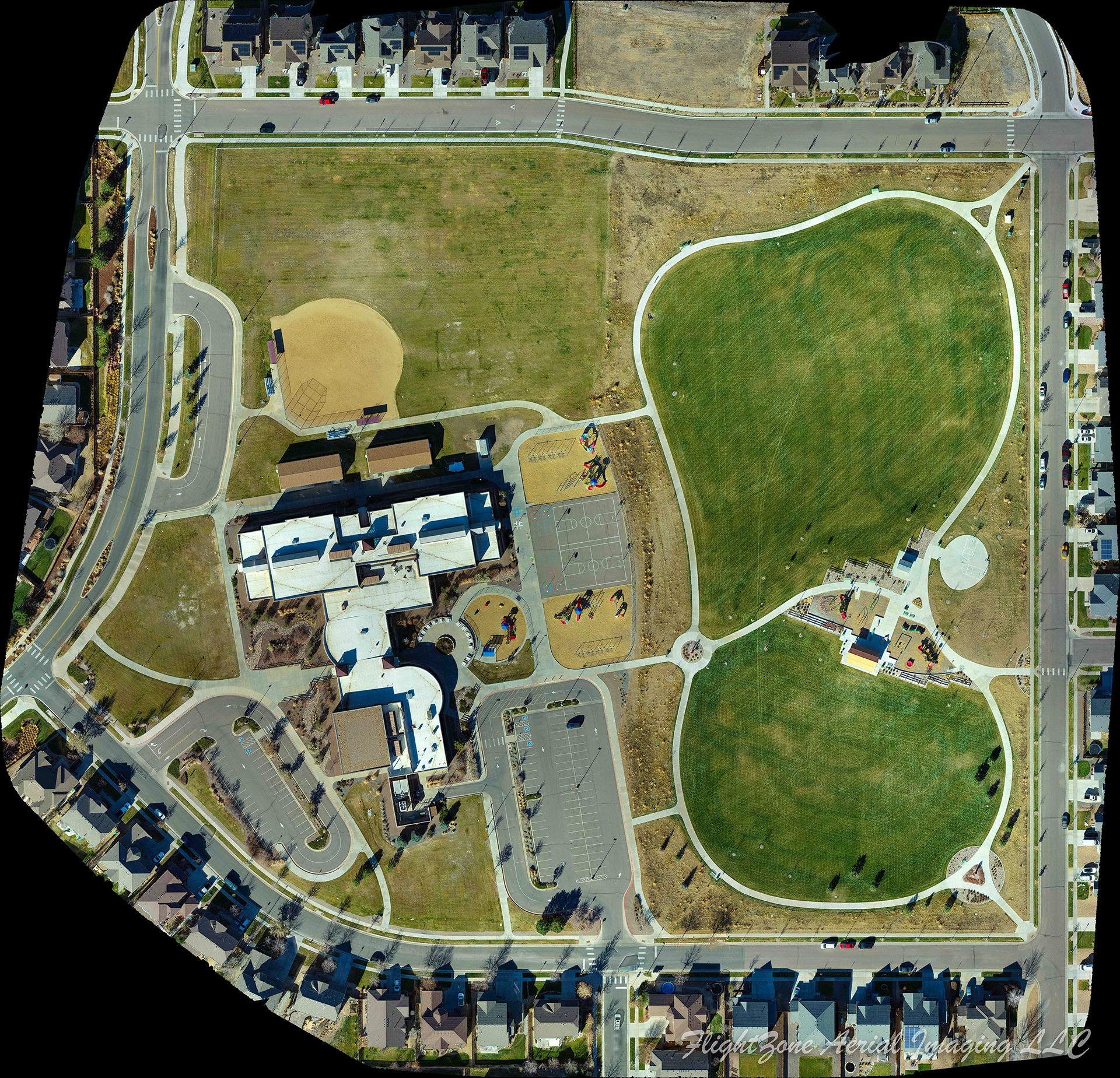
33 Acre Map created from 396 drone images.  .66 inch/pixel resolution.

Elevation "Heat Map" Image showing relative elevation within map

Manipulating 3D Image Created from Drone Mapping

Home
Gallery

You may also like

2020
Community Images
2020
Inspection Images
2020
Agricultural Images
2020
Event Images
2020
Real Estate Images
2020
Miscellaneous Images
2020
Construction Images
2020
Landscape Images
2020
Commercial Images
↑Back to Top
Powered by Adobe Portfolio